ELIOS 3

Drone

Digitising the Inaccessible

Elios 3, the first indoor drone designed for mapping and inspection, makes it easy to convert hard-to-reach asset data into valuable digital insights. With its exceptional intelligence, versatility, and stability, it offers a seamless solution for efficient data collection and analysis.

Drone-based inspection is no longer a future innovation –
it’s essential in today’s fast-paced digital world.

As the 4th industrial revolution advances, organisations are driving digital transformation in their industrial processes, aiming to reduce costs and improve worker safety.

The Elios 3 elevates inspections and mapping, helping industries seamlessly achieve these objectives.

Powered by computer vision and LiDAR mapping,
Elios 3 is a versatile indoor drone that simplifies systematic inspections.

It eliminates the need for extensive training, enables intuitive reporting through a 3D asset model, and integrates situational awareness directly into the piloting app.

Training

Confined Space UAV Training Facilities

Inspection Services

Equipment Maintenance

Consultancy Service

Sales, Lease, Rental

Q&A

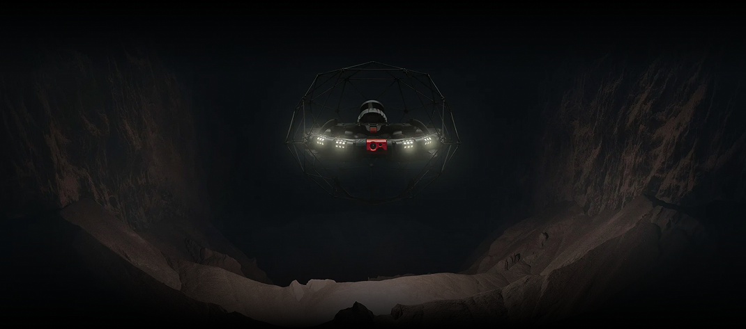
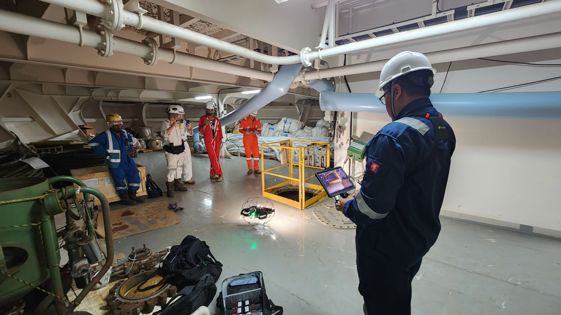
Most drones commonly used outdoors rely on GPS signals for localisation and stability. However, they face challenges when operating indoors or in confined spaces due to the lack of GPS availability in these environments. In contrast, specialized drones like the Elios 3 are designed for GPS-denied environments, offering reliable localisation and stability without the need for GPS. These drones are specifically engineered to navigate in challenging conditions, such as dark, dusty, and confined spaces.

The Elios 3 is built for contact during flight, featuring a lightweight carbon-fiber cage that provides impact protection when the drone comes into contact with walls or structures. Additionally, the drone is equipped with bi-directional rotors, enabling it to autonomously flip back into an upright position mid-flight, even if it is toppled.

The Elios 3 is equipped with a 'Return-to-Signal' (RTS) safety feature that activates automatically if the connection with the remote control is lost. In RTS mode, the drone can autonomously retrace its flight path, returning to the takeoff point or continuing its flight until the connection with the remote control is restored.

The Elios 3 is equipped with an onboard LiDAR module that generates a real-time 3D map or model of the environment it is flying through. This enhances both the pilot’s situational and locational awareness while navigating the drone in confined spaces. The 3D map is also invaluable for identifying and localizing Points of Interest (POIs), such as defects detected during inspection flights. Additionally, the Elios 3 serves as a Scan-to-BIM tool, allowing the 3D model of the space to be used for creating BIM models and performing volumetric measurements.

The Elios 3 is designed with modular payload integration in mind. Currently, available optional payloads include the Radiation Detection Payload, UT Gauging Payload, Surveying Payload, and Flammable Gas Detector Payload. Additional payloads will be introduced progressively to expand its capabilities.

Request a Demo

Would love to see a demo? Share your contact details with us and our team will reach out to you shortly. 

Scroll to Top