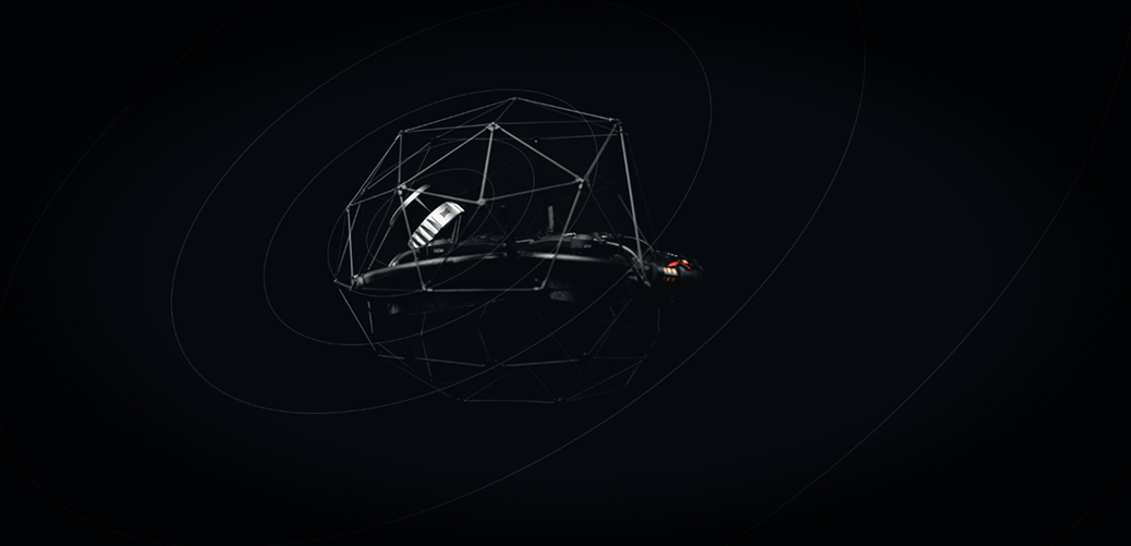
Elios 3 Surveying
Payload
Surveying the inaccessible
Safely create centimeter accurate scans of hard-to-reach areas, with the Elios 3 Surveying Payload, the next revolution in 3D data capture by Flyability.

Bridge data gaps in challenging environments
Comprehensive data is key to supporting operational decisions. Yet many hazardous environments are beyond the reach of existing data capture technologies.
Flyability’s Surveying Payload turns the Elios 3 into a flying mobile scanner that can fit through openings as small as 50x50cm, and create high resolution scans beyond line of sight, allowing industry professionals to provide rapid insights that are not accessible with traditional tools or other UAV technologies.
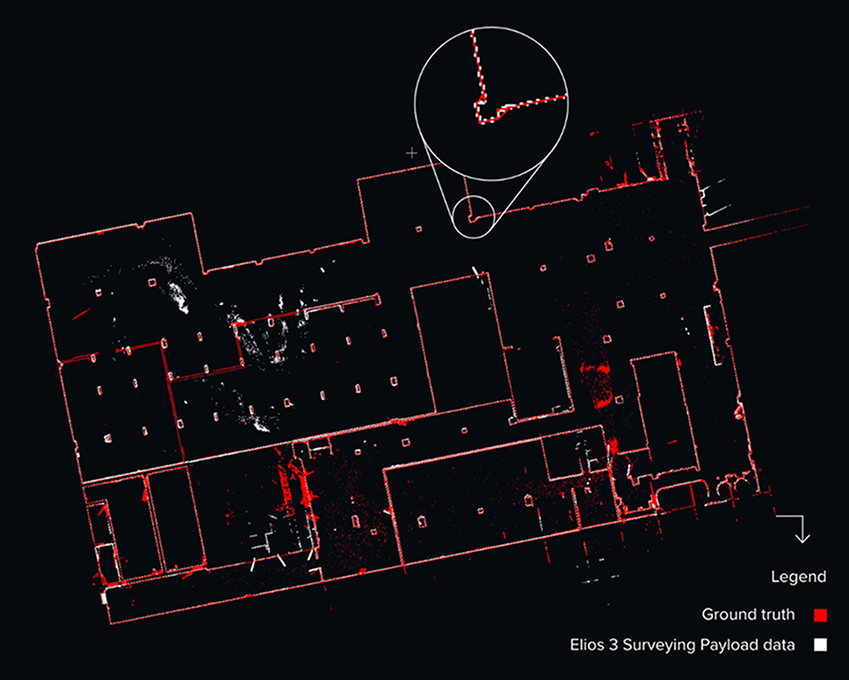
Survey-grade accuracy
The high resolution Ouster OS0-128 Rev 7 LiDAR sensor in combination with the world’s leading FARO Connect SLAM algorithm create incredibly accurate 3D maps and digital twins of the most inaccessible spaces with centimeter precision – for accurate measurements and greater insights.
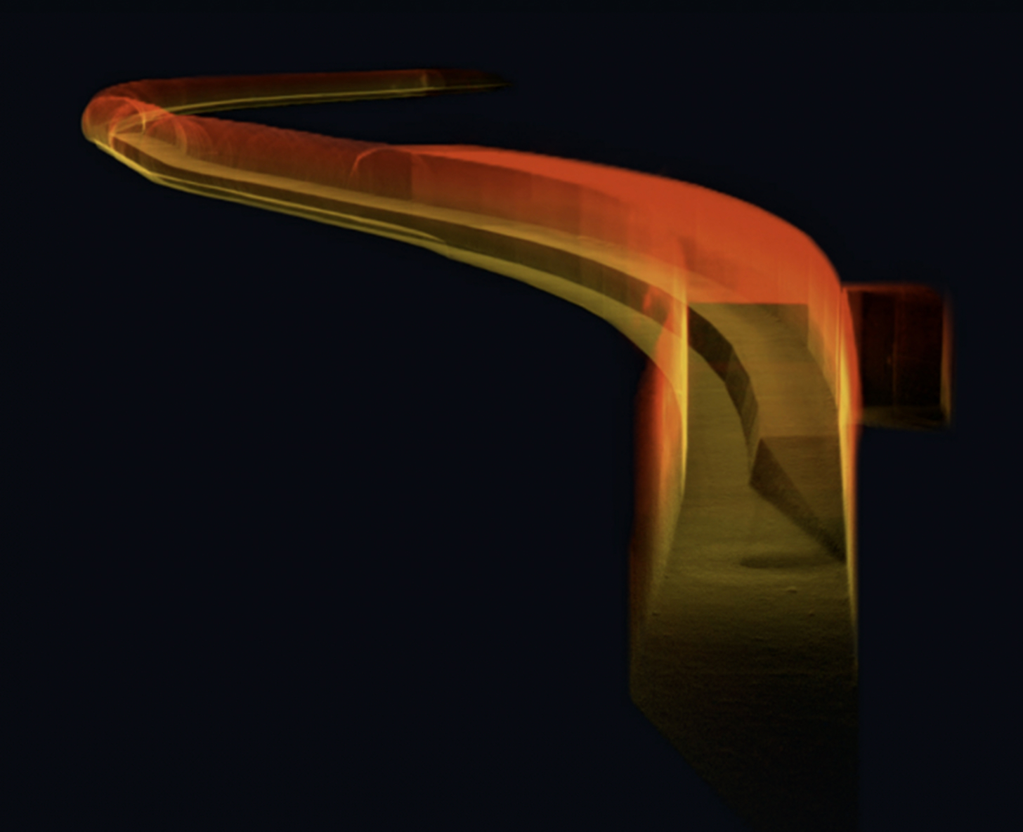
New mapping capabilities
Powered by the latest Ouster REV 7’s supercharged L3 chip, the Elios 3 has the ability to capture points further apart and to detect more usable visual features. This maximizes the chance for the SLAM algorithm to converge when computing 3D models of cylindrical and symmetrical environments such as collectors, chimneys, culverts, or underground galleries.
*Accuracy may vary depending on the geometry of the mapping environment. Read our detailed accuracy report to further assess the technology fit for your use case.
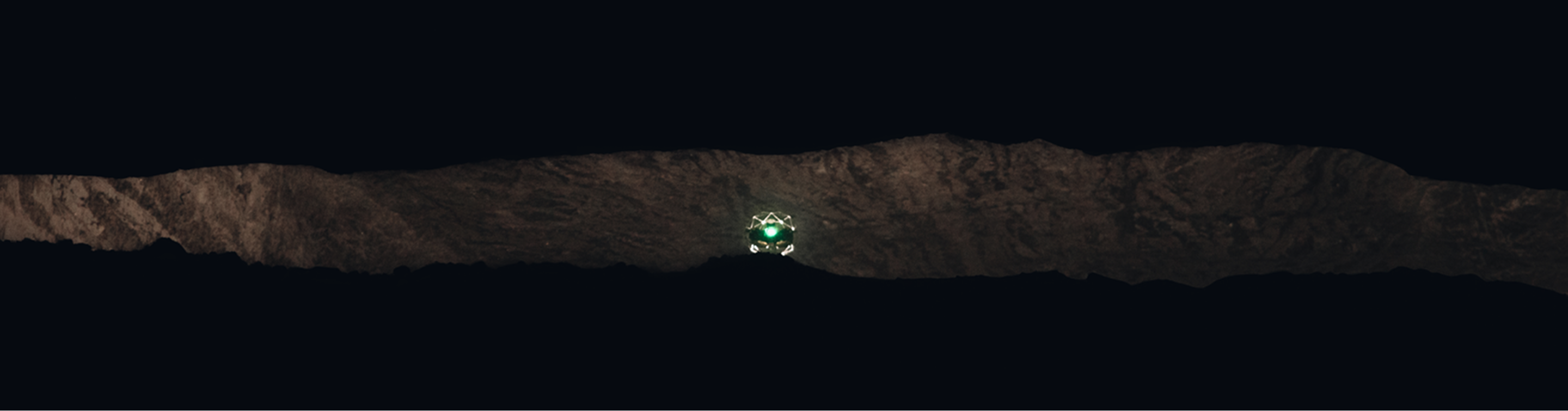
Stunning point clouds
Capture rich, detailed point clouds of the most complex indoors, operating from a safe location. With Elios 3’s Surveying Payload you can effortlessly create comprehensive visual representations of challenging indoor spaces, allowing for precise mapping and analysis.


Q&A
Most drones commonly used outdoors rely on GPS signals for localisation and stability. However, they face challenges when operating indoors or in confined spaces due to the lack of GPS availability in these environments. In contrast, specialized drones like the Elios 3 are designed for GPS-denied environments, offering reliable localisation and stability without the need for GPS. These drones are specifically engineered to navigate in challenging conditions, such as dark, dusty, and confined spaces.
The Elios 3 is built for contact during flight, featuring a lightweight carbon-fiber cage that provides impact protection when the drone comes into contact with walls or structures. Additionally, the drone is equipped with bi-directional rotors, enabling it to autonomously flip back into an upright position mid-flight, even if it is toppled.
The Elios 3 is equipped with a 'Return-to-Signal' (RTS) safety feature that activates automatically if the connection with the remote control is lost. In RTS mode, the drone can autonomously retrace its flight path, returning to the takeoff point or continuing its flight until the connection with the remote control is restored.
The Elios 3 is equipped with an onboard LiDAR module that generates a real-time 3D map or model of the environment it is flying through. This enhances both the pilot’s situational and locational awareness while navigating the drone in confined spaces. The 3D map is also invaluable for identifying and localizing Points of Interest (POIs), such as defects detected during inspection flights. Additionally, the Elios 3 serves as a Scan-to-BIM tool, allowing the 3D model of the space to be used for creating BIM models and performing volumetric measurements.
The Elios 3 is designed with modular payload integration in mind. Currently, available optional payloads include the Radiation Detection Payload, UT Gauging Payload, Surveying Payload, and Flammable Gas Detector Payload. Additional payloads will be introduced progressively to expand its capabilities.
Request a Demo
Would love to see a demo? Share your contact details with us and our team will reach out to you shortly.